This article is about the changing view as you walk along a street, represented in photographs. A sequence of photographs taken in a small area is closer to our perceptions of walking through a place than a static single image. What is excluded from one image is revealed in another. As you move closer to a building, the perspective changes, the juxtaposition with other buildings is seen.
In his 1998 book Interrupted City, Gabriele Basilico presents a photographic exploration of modern Milan. The book contains several groups of three, four or five photos, each group taken within a small area, looking in different directions at the same buildings and space. Together, on close reading, they describe a small part of the city in a three dimensional, dynamic manner.
It is not easy to see how the pictures connect, and Basilico leaves it up to the viewer to see, but in each group there is a building that appears in each image, distant or close up. If you want to take the time, the photos are highly revealing of that particular place.
The Concise Townscape is one of the seminal texts of urban design, in which Gordon Cullen analyses how we experience cities as we walk through them. The term has become a commonplace, but the book demonstrates a vast number of perceptual phenomena, which he names and illustrates with drawings and photographs.

One of the key concepts is ‘serial vision’ – the sequence of openings, building groups, vistas, turns, closures that we see walking through streets and spaces.
The book is rich with examples of these visual incidents, shown mainly in plans and in sketches. In one part of the book Cullen describes the concept of ‘closure’, where a linear street is perceived as contained scenes, while retaining the sense of progression. Using Blandford Forum in Dorset as an example, he uses photographs to show each stage of progression along a street. He uses a crude handwritten ‘A’ to identify a building appearing in successive pictures.

But this has always fascinated me because Cullen makes a mistake – close scrutiny shows he has taken a step back rather than forward and marked the wrong building.
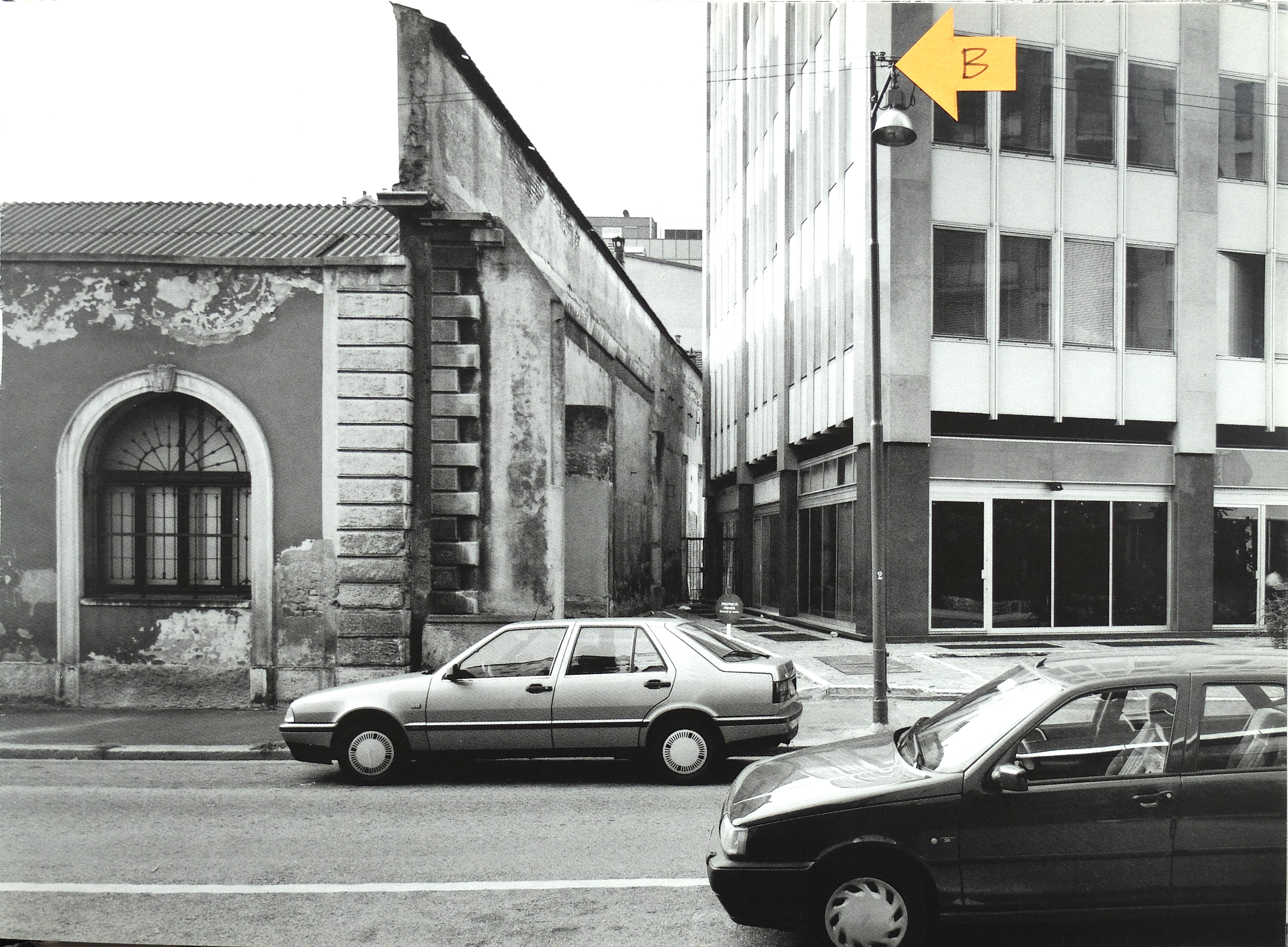
However, I have used Cullen’s marker device to navigate one set of Basilico’s Milan pictures, In the pictures that follow, I have marked the same building which is seen from different directions.
In this sequence, shown in the order they appear in the book, Basilico photographs a nondescript part of the post-war redeveloped city. But this is a mixed-use, mixed-age area with a residential high-rise and a hotel next to offices. The focus of the photos is an old warehouse or factory building that has remained amongst the new developments and now sits awkwardly cheek by jowl with the office building at the centre of the three streets Basilico navigates.


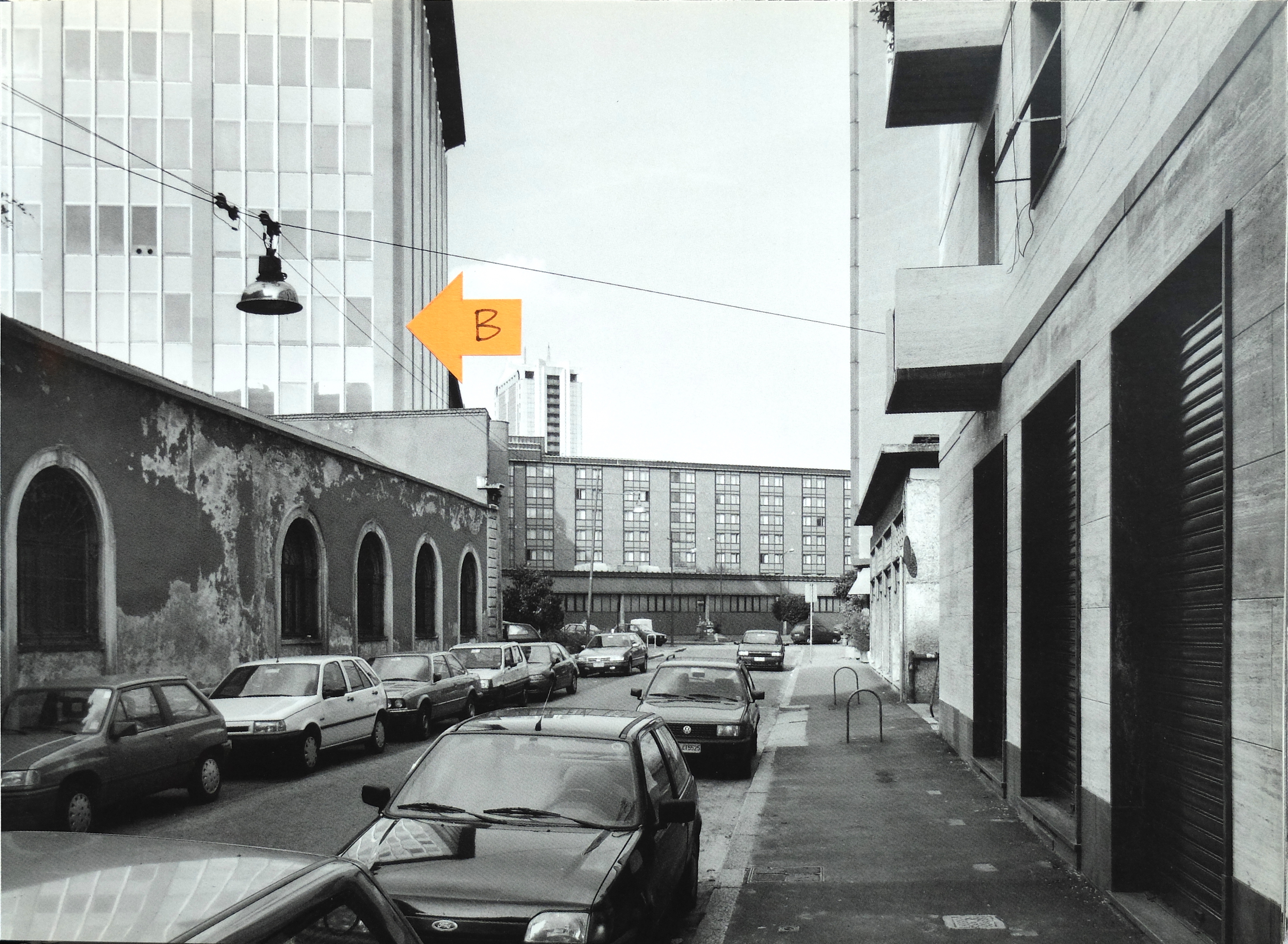
there is one other feature that is relevant to reading these pictures and understanding them in the context of Milan. The fourth picture shows a building in the background that is the subject of a previous group of pictures. This is one of a pair of tower blocks next to Garibaldi Railway Station. With that knowledge, the location of the area in these pictures, just south of the station makes more sense.


